
*
By Hola Nebraska
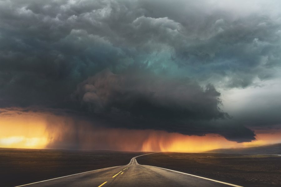
Nebraska will face an elevated storm risk Friday afternoon and evening, with damaging winds, large hail, heavy rain and the possibility of isolated tornadoes as holiday weekend celebrations begin.
Central and eastern Nebraska will face a severe storm threat Friday, July 3, just ahead of several Fourth of July weekend activities. The Storm Prediction Center placed an area from central Nebraska into western Iowa under an Enhanced Risk, level 3 of 5, because of the potential for strong storms during the afternoon and evening.
The risk includes parts of the Lincoln and Omaha areas. According to the National Weather Service Omaha/Valley, the severe weather threat will increase late in the afternoon and evening, with damaging winds as the main concern, along with large hail, localized flooding and possible tornadoes.
The update comes during a weekend with concerts, fireworks, games, family gatherings and outdoor activities in several Nebraska cities.
The highest risk will arrive Friday afternoon and evening
Storms could develop in Nebraska during the afternoon and become more organized into the evening. The Storm Prediction Center indicated that damaging winds and large hail are expected from parts of Nebraska into Iowa on Friday.
The federal agency said some storms could form in western South Dakota and Nebraska during the afternoon, organize overnight and move east with a risk of severe wind and hail. In southeast Nebraska, a warm and humid air mass will increase instability, with the potential for storms capable of producing large hail and damaging winds during the afternoon and evening.
In Lincoln, the National Weather Service forecast a high near 94°F for Friday, with south-southeast winds of 11 to 14 mph and gusts up to 25 mph. For Friday night, the forecast calls for likely showers and storms before 4:00 a.m., with a 60% chance of precipitation.
Lincoln and Omaha are within the area of concern
The local update from 10/11 NOW indicates that much of central and eastern Nebraska is under an Enhanced Risk for Friday, meaning numerous severe storms are possible. Damaging winds will be the main threat.
The forecast also includes the possibility of large hail and isolated tornadoes. Storms that develop late in the afternoon and during the evening could produce wind gusts above 75 mph, hail up to the size of a golf ball and heavy rain in some areas.
In Lincoln, that timing could overlap with events scheduled for Friday night. In Omaha and other eastern Nebraska cities, the risk could also affect outdoor celebrations, travel, fireworks and family gatherings.
Friday morning and part of the afternoon could remain partly cloudy, with periods of sun, but the chance of storms will increase later in the day.
Heat will also be part of Friday’s risk
In addition to the storm threat, Friday will bring hot and humid conditions. 10/11 NOW reported that high temperatures will range from the mid-80s to the mid-90s, with heat index values near 100°F across much of eastern Nebraska.
The National Weather Service recorded 79°F in Lincoln at 10:54 a.m. Friday, with 74% humidity and a dew point of 70°F. Those conditions reflect the available moisture ahead of storm development later in the day.
The heat can affect people who spend several hours outside before severe weather arrives. Events with lines, parking lots, outdoor meals, concerts and areas without shade can feel more intense during the afternoon.
The Fourth of July could improve in Lincoln, but uncertainty remains
For Independence Day, the Lincoln forecast shows partly sunny conditions, with a high near 91°F. Saturday night keeps a 30% chance of showers and storms, mainly between 1:00 a.m. and 2:00 a.m.
10/11 NOW indicated that some rain or storms could continue early Saturday, but rain chances and cloud cover would decrease during the morning. By the afternoon of July 4, much of the state would have partly sunny to mostly sunny conditions, although western and southern Nebraska could see new storms later in the afternoon or evening.
Saturday’s severe risk will be lower than Friday’s, but it will not disappear completely. In parts of western and south-central Nebraska and northern Kansas, isolated to scattered storms could develop, with large hail and damaging winds as the main threats.
A watch means preparation, while a warning requires shelter
The National Weather Service distinguishes between a severe thunderstorm watch and a warning. A Severe Thunderstorm Watch means conditions are favorable for severe storms and people in the area should be ready to act. A Severe Thunderstorm Warning means severe weather is happening or about to happen, and action should be immediate.
The National Weather Service safety recommendation is to seek shelter inside a sturdy building during thunderstorms, because that type of structure offers better protection from lightning, large hail, damaging winds, heavy rain and tornadoes.
For lightning risk, the federal rule is clear: when thunder is heard, the risk of a lightning strike is already nearby. NOAA says outdoor activities should not resume until 30 minutes after the last clap of thunder.
The weekend will remain hot
Sunday is expected to be mostly sunny to partly cloudy, with high temperatures ranging from the upper 80s to upper 90s in Nebraska. The chance of isolated showers or storms will be 20% during the afternoon and early evening, with no severe risk indicated so far by 10/11 NOW.
The start of next week will continue with temperatures near or above average. The best chances for rain and storms would arrive Wednesday and Thursday, according to the local weather update.
The National Weather Service forecast for Lincoln was updated at 10:35 a.m. Friday, July 3, 2026, and covers the period valid through July 9.
Stay informed about what’s happening in your community. Your source for inspiring stories: visit HolaNebraska.org for news, culture and community updates across Nebraska.